Many navigation and sailboat racing apps used on desktops, smartphones, and tablets allow import of mark locations. This feature is often listed under the waypoint settings. GPX is the format for such files.
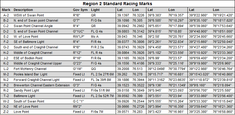
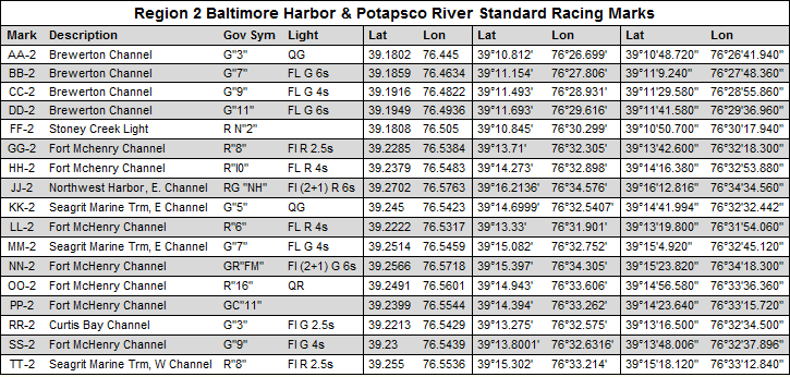
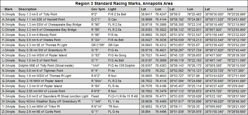
The Chesapeake Bay Yacht Racing Association (CBYRA) publishes in their "Green Book" mark locations used for their regattas. These mark locations are listed in the following tables and GPX files. The data was taken from the CBYRA Green Book for 2018. One should check that the data is still current and accurate.
Open the link and download the GPX file. Save it where your app can find it (by more than one app?). Then import the saved GPX file into your app:
For those times when import of the GPX file won't work, the mark locations are listed in the tables below with the latitude and longitude coordinates listed in three different formats:


